
Dams and Hydropower
Transforming our environment and communities, with integrity and vibe
Everything you need to build a great website on HubSpot.
Lorem ipsum dolor sit amet, consectetur adipiscing elit, sed do eiusmod tempor incididunt ut labore et dolore magna aliqua.
A few favorite projects
Anchor QEA is a nationally recognized environmental firm focused on multidisciplinary planning, science, and engineering.
Our energetic and talented team of biologists, scientists, planners, engineers, and landscape architects from offices across the United States works closely with clients toward common goals for fisheries, habitat restoration, and water resources projects.
We provide a full range of science and engineering services. We have earned a reputation with our clients for our proactive approach on projects, technical expertise, quality of work, and commitment to meeting schedules and budget.
Services
- Hydrodynamic modeling
- Fish passage engineering and evaluations
- Geomorphology, dam removal, and riverine assessments
- Field studies and surveys
- Habitat restoration and mitigation
- Regulatory compliance support
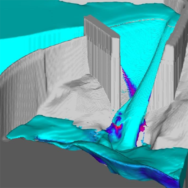
Hydrodynamic Modeling
Anchor QEA performs multidimensional hydrodynamic modeling to address clients’ most challenging problems. The team’s computational fluid dynamics (CFD) modeling capabilities can realistically and efficiently simulate fluid flows in the natural and built environments. Read more...
Anchor QEA uses industry-leading FLOW-3D software to simulate free-surface flows in one, two, and three dimensions. Multidimensional CFD modeling provides a detailed understanding of transient and complex flows, including spillway design, fish passage, contaminant and sediment transport, river hydraulics, and design.
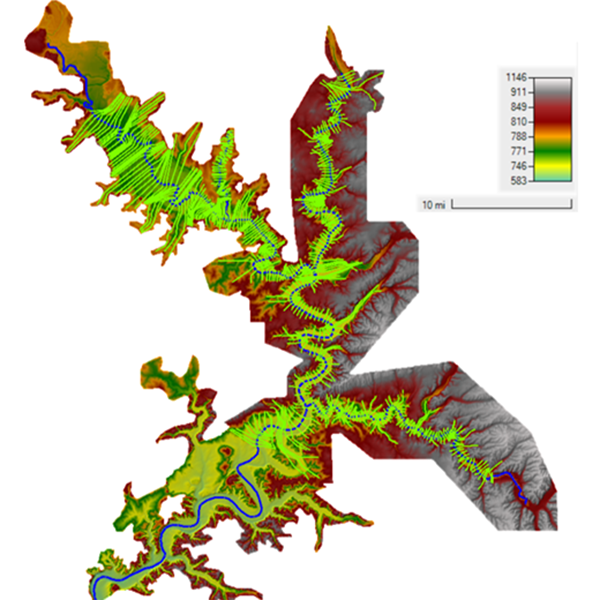
Regulatory Compliance Support
Anchor QEA provides a range of services to support hydropower relicensing and regulatory compliance. These include hydraulic modeling in HEC-RAS and SRH-2D, dam breach analyses, flood studies, sediment transport evaluations, field campaigns, and emergency management to help operators and owners navigate complex regulatory environments. Read more...
We conduct engineering studies to support Federal Energy Regulatory Commission (FERC) licensing efforts, inflow design flood (IDF) analyses, breach simulations, and floodplain and inundation extent mapping.
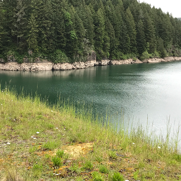
Fish Passage Engineering
As recognized leaders in fish passage projects in the Pacific Northwest, Anchor QEA works on the assessment, design, analysis, and construction phases of fish passage projects to revitalize rivers, lakes, streams, and wetlands. Read more...
As a complement to fish passage engineering, our engineers and scientists are committed to developing strategies that include innovative solutions for adult and juvenile fish passage evaluations, hydrologic and hydraulic modeling, dam removal, ecosystem restoration design, bank protection and stabilization, and natural channel design. These strategies rely heavily on our high-quality data management, sampling, and monitoring services.
Dam Removal and Riverine Assessments
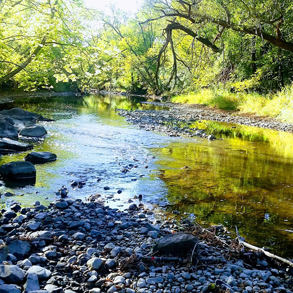
Anchor QEA provides a broad spectrum of services related to riverine management, including fluvial geomorphology, flood assessment, bank erosion, channel migration, and floodplain connectivity. Delivering cost-effective, sustainable solutions, the team has worked on projects performing erosion studies and monitoring, sediment loading, land-use impacts, and fluvial assessments. Read more...
Applying cutting-edge analytics and stratigraphy skills, Anchor QEA evaluates spatial trends of current stream stability and how geomorphic conditions may influence future stream stability and long-term sustainability.
Field Studies and Surveys
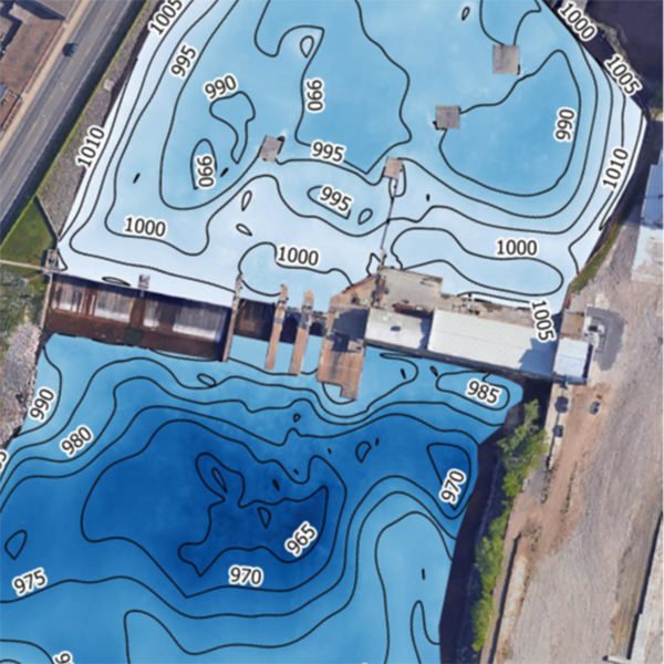
Anchor QEA provides hydrographic surveying services to clients seeking assistance with underwater site investigation, sediment investigations, sediment transport studies, and dredge operations. The team provides high-resolution mapping and side-scan sonar imagery using the latest technology in underwater sensing. Hydrographic surveys can reveal critical information that otherwise would remain hidden below the water’s surface. Read more...
With a commitment to safety and excellence, Anchor QEA assists environmental and construction projects in rivers and lakes across the country. Obtaining accurate data is critical to the success of our clients’ projects. Whether it be on land or beneath the water’s surface, Anchor QEA is experienced in collecting and analyzing survey data in a variety of settings.
Habitat Restoration and Mitigation
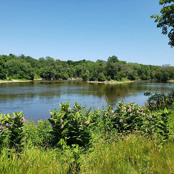
Anchor QEA fisheries biologists and engineers provide deep technical expertise and experience evaluating and mitigating impacts to flows and fisheries for the hydropower industry. Our team has decades of experience evaluating the impacts of hydropower projects on river hydrology, geomorphology, and biological resources. Read more...
Our biologists and engineers have successfully completed multiple projects, specializing in dam removal feasibility analyses, design, and implementation; fish passage improvements, with a focus on salmon and cold-water fisheries; mitigation planning and implementation; and development and implementation of fish and water quality monitoring programs.
Spillway Capacity CFD Study for Clear Branch Dam
Middle Fork Irrigation District, Oregon
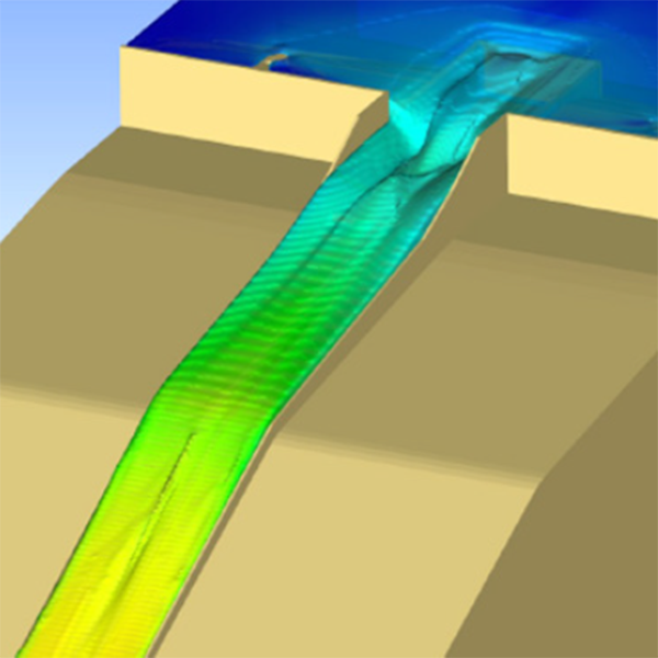
Anchor QEA performed multidimensional CFD modeling to analyze the primary spillway capacity at Clear Branch Dam. The modeling evaluated the capacity of different design alternatives to replace the existing configuration with a modified drop inlet and training wall heights. Read more...
Results of the simulations provided numerical details of flow rate, water surface elevation, pressures on the spillway, energy dissipation downstream of the spillway, and vertical profiles of velocity and pressure along flow paths. CFD modeling supported the design portion of the project, enabling the design team to quickly and efficiently validate spillway alternatives and optimize the design selection.
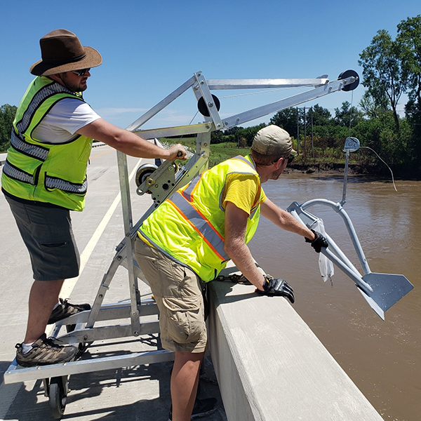
Hydropower FERC Relicensing Sedimentation Study
Oklahoma
Anchor QEA performed multiyear water level monitoring, velocity profiling, and sediment transport modeling analysis in support of a hydropower relicensing project in an Oklahoma reservoir. The study area entailed approximately 120 river miles split between several tributaries. Read more...
The evaluation involved continued field work as well as GIS analysis. Model inputs were developed from substrate sampling and testing; this included specialized erodibility analysis of cohesive silts and clays that dominated much of the sediment transport regime, core sampling and sediment dating through cesium-137 evaluation, and grab samples throughout the study area. Anchor QEA used the sediment transport model to estimate future deposition and potential impacts on water levels over a 50-year period under varied operating parameters and sediment inflows.
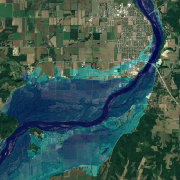
Alliant Energy Dam Failure Analysis
Sauk City and Prairie Du Sac, Wisconsin
Anchor QEA conducted 1D and 2D hydraulic modeling with HEC-RAS to simulate a dam failure of the Prairie du Sac Dam on the Wisconsin River. Read more...
The model extended from the upstream extent of Lake Wisconsin to the confluence of the Wisconsin and Mississippi rivers. Potential failure modes at normal conditions as well as flood flow were analyzed, and 2D modeling capabilities were used for overbank flow evaluations in Sauk City and Prairie du Sac. Results of the analysis aided in development of inundation mapping and flood characteristic determination downstream of the dam in both fair weather and Probable Maximum Flood conditions. The data was then incorporated into updated Emergency Action Plan maps for the area.
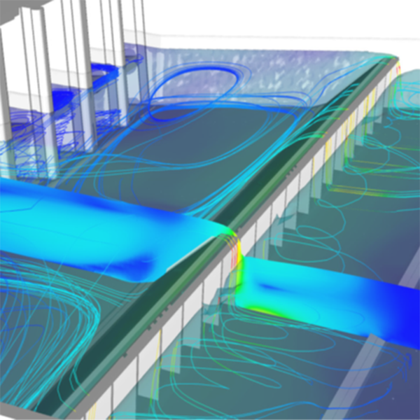
Wisconsin Public Service Corporation Dam Tailrace Weir Study
Castle Rock, Wisconsin
Anchor QEA conducted a field investigation and modeled the tailrace of the Castle Rock hydroelectric dam on the Wisconsin River. Decreased water levels downstream of the dam caused by ongoing erosion had led to decreased power generation. A tailrace weir was proposed to maintain higher water surface elevations and allow for uninterrupted generation at the site. Read more...
Anchor QEA collected bathymetric and topographic information at the site, then developed that data into the CFD model. The project team used FLOW-3D, an industry-leading CFD software package, for modeling, analysis, and visualization of results. The model results showed that scour was unlikely to worsen given the bed shear stresses predicted by the model and the grain size of local sediment. They also allowed weir designers to select an appropriate height and shape to minimize risk of concrete failure due to cavitation or hydraulic shear stresses.
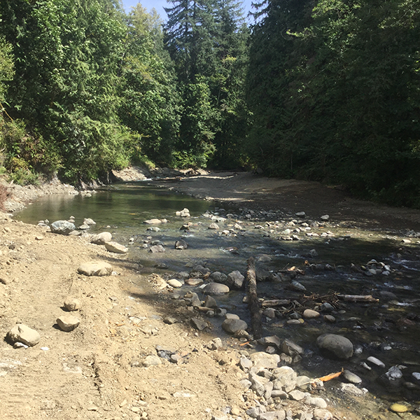
Pilchuck Dam Removal
Granite Falls, Washington
Anchor QEA provided planning, design, and construction services to support the full removal of the aging and obsolete 15-foot-high concrete Pilchuck Dam and associated upstream wooden crib dam. Removal was needed to restore access to 37 river miles of upstream habitat and immediately helped address dwindling salmon stocks. Read more...
Anchor QEA developed a channel grading and habitat restoration plan, a multiphase demolition and water control plan, and a water quality monitoring plan and provided fish rescue, water quality monitoring, and construction inspection. A reach-scale geomorphic analysis and hydraulic modeling was also conducted to support sediment transport analysis and inform sediment management options. The Washington State Department of Ecology was concerned about potential water quality impacts due to increased pH during the removal process and required a rigorous step-by-step method of reducing or eliminating potential impacts. Anchor QEA also prepared preliminary designs and a cost estimate for funding solicitation and support.
Inflow Design Flood Study
Danville, Virginia
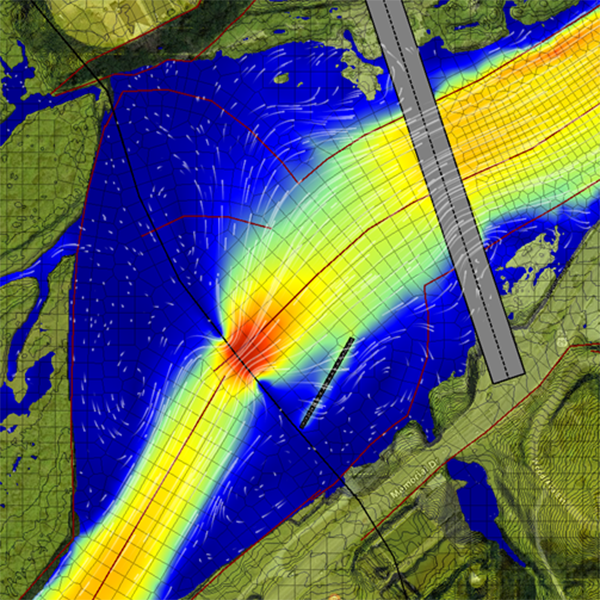
Anchor QEA performed an IDF study to support FERC compliance. Study results were used to determine the IDF and inform dam hazard potential classification recommendations in accordance with FERC Chapter II engineering guidance. Read more...
Anchor QEA used HEC-RAS to develop a 2D dam breach model. The model included a dynamically-routed reservoir and approximately 7.5 miles of river below the structure. Simulation results for the sunny day, 100-year, and zero-freeboard flow conditions were compared to their respective non-failure scenarios to evaluate incremental impacts due to a hypothetical failure.
Fish Passage Design
Chehalis River Basin, Washington
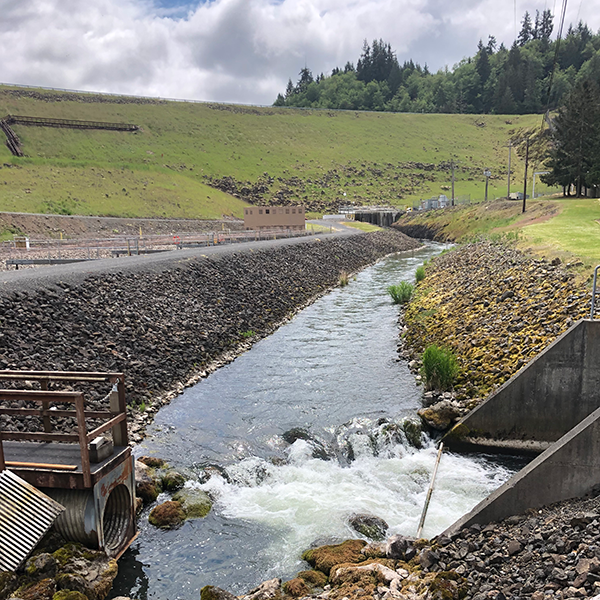
The 195-foot-high, earth-fill Skookumchuck Dam currently blocks access to all anadromous fish species to the upper half of the Skookumchuck River (up to 22 miles). For the Office of Chehalis Basin, Anchor QEA led a feasibility analysis related to potential physical or operational modifications that could be made to the dam. Read more...
The analysis included evaluating modifications focused on flood reduction, aquatic species benefits, or a combination of both benefits. Additionally, a detailed hydrology and water budget, a detailed reservoir model, biological surveys, a bathymetric survey of the lower river, hydraulic modeling of the lower river and floodplain, a detailed model of the fish sluice, documentation of upper watershed habitat conditions (using LiDAR and high-resolution aerial photography), and an initial evaluation of potential impacts to water rights were included in the analysis. The analysis was completed in less than 1 year and the information provided in this analysis supported funding decisions in the 2023-to-2025 Washington legislative budget.
Little Falls Dam Stilling Basin Study
Hudson, Wisconsin
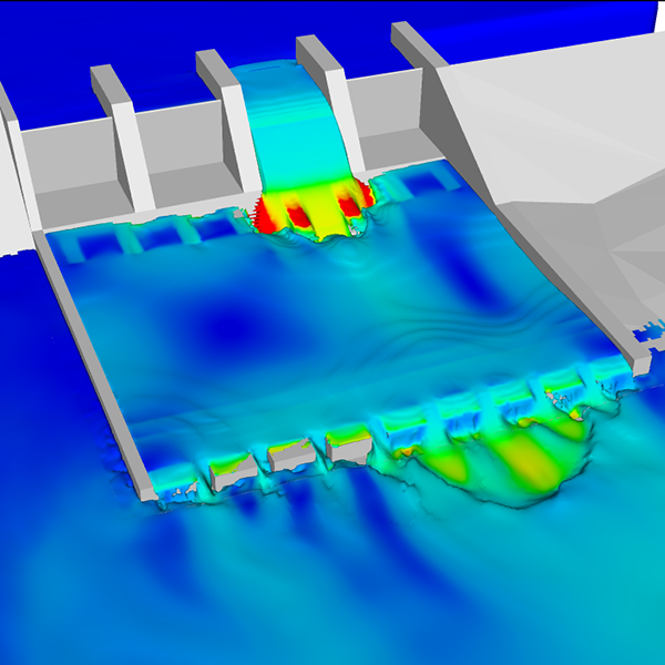
Anchor QEA performed multidimensional CFD modeling for the Wisconsin Department of Natural Resources (WDNR) to analyze a proposed stilling basin at the Little Falls Dam in Willow River State Park near Hudson, Wisconsin. Read more...
Anchor QEA used FLOW-3D for modeling, analysis, and visualization of results. Model runs were completed for the 1-, 2-, and 100-year flow events. Investigations included overtopping simulations, analysis of flow patterns, and evaluation of hydraulic forces on energy-dissipation blocks within the proposed stilling basin. CFD results were used by the client to inform design strategies, quickly visualize flow patterns, and efficiently validate potential solutions during a range of flow events with different gate opening configurations.
